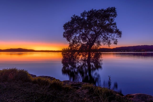
Best Central Coast Photo Spots
Top 20 Photo Spots On The Central Coast, NSW, Australia:
Sunrise, Sunset and everything in between
Just over an hour north of Sydney It’s easy to see why the Central Coast is so popular for a weekend visit. But for photographers it has so much more to offer that it would take more than a weekend!.
From Patonga to Norah Head, and so many beautiful locations in between, we truly are spoiled on the Central Coast. I may be biassed, but did I mention Terrigal, Avoca, Somersby Falls, Macmasters Beach … Ok, read on for my full list of Central Coast photo spots.
Many of the images in this post are available for purchase, so head to my shop, Sam Wilson Photography , and check them out.
The Central Coast of NSW, Australia is an area blessed with natural beauty. As a photographer you are spoilt for choice – where will you shoot today?
With a blend of beaches, waterfalls, and natural forests, there are just so many options.
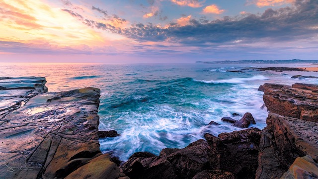
Avoca Beach
Equally popular with surfers, fishers and photographers, Avoca Beach always has something going on – even before dawn. This can be accessed at most tides, however to be avoided in big swells and rock shoes I would say are essential.
Simply park in the surf club carpark, head right along the pathway in front of the surf club and before long you’ll be surrounded by compositions to photograph.
This is a relatively short walk from the car and best of all coffee is available right there. There’s also a few nice cafes for post sunrise breakfast right there – just put your gear back in the car and it’s coffee time!
Avoca may be first alphabetically but I also have to say if you only have time to get to one on your (first) visit – this has to be my number one Central Coast photo spot!
Avoca Beach Location Information –
Parking and access – Avoca Beach Surf Lifesaving Club. Easy to find a space for sunrise but gets very busy during the day. Short walk in front of the surf club to the right.
Google Maps Link – Avoca Beach Surf Life Saving Club
Features – beach rock pool, rock ledges, headland and waves
Best conditions – accessible most times but show caution at high tide and rough seas
Nearest coffee and breakfast – at the surf club itself and Sands Cafe at the end of the car park.
Forresters Beach
This is a fairly quiet location, and it can be a bit of a trek walking on the sand (my least favourite walking surface), but well worth it. You will usually only come across locals, especially at sunrise – and plenty of 4-legged doggos as well enjoying their morning outing.
Located in between The Entrance and Terrigal it is a fairly central location, and also popular with local surfers because of the reef breaks. Truly a hidden gem among these Central Coast photo spots.
Forresters Beach Location Information
Parking and access – end of Crystal street, Forresters beach. Stairs down to the beach, then can go right or left – most favour heading right to the interesting rock platforms.
Google Maps Link – Crystal St
Features – beach, rock platform and green rocks depending on the time of year.
Best conditions – low tide
Nearest coffee and breakfast – di Matteos, Forresters Beach

Girrakool
Lesser known than Somersby Falls, Girrakool has a lovely bushwalk featuring a couple of little waterfalls well worth a visit.
Great to visit after sunrise (and a bit of rain of course) and if you time it right, it’s a great picnic area. Check out the National Parks Guide for all the info.
Girrakool Location Information
Parking and access – Not far off the freeway. Plenty of parking but as this is in a National Park, this is paid parking. Toilets and picnic tables available.
Google Maps Link – Girrakool loop track
Features – Aussie bush and waterfalls. Possible sightings of wallabies, and plenty of birds.
Best conditions – after rain, and early in the day or overcast for best photography opportunities of the waterfall.
Nearest coffee and breakfast – Waterfall Cafe, Kariong.
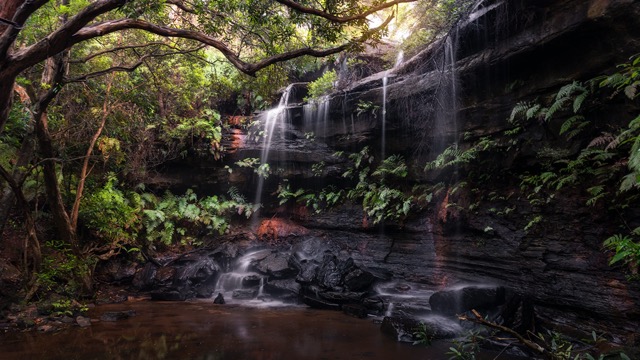
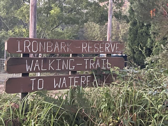
Ironbark Falls
These truly are a well-kept secret located in the rural area of Mangrove Mountain. I have included a photo of where to enter the walk in as otherwise you would never know they are there.
It’s a fairly short, easy walk – around fifteen minutes – but parts of it can get very slippery after rain. This is of course the best time to go, so wear good shoes and take it slowly.
The picturesque falls themselves are surrounded by a small, shaded sand area. Plants and ferns surround the falls.
Ironbark Falls Location Information
Parking and access – This is a blink and you miss it location with very little signage. Head to Ironbark Road, Mangrove Mountain and look for the sign shown below. There is no real parking but as it’s a relatively unknown area, this shouldn’t be an issue. From parking it a short (about fifteen minutes), but sometimes very slippery,) walk following the signs.
Google Maps Link – Ironbark Rd
Features – lovely secluded waterfall and Aussie bush.
Best conditions – within a few days of rain otherwise you may just find a trickle.
Nearest coffee and breakfast – Cafe at Mangrove Mountain – great bacon and egg rolls.
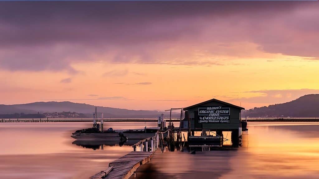
Koolewong
Koolewong is the only location on this list that isn’t a beach so that alone makes it special. Located at the south end of the Central Coast it is home to a beautiful marina and restaurant (not for breakfast unfortunately), it is also nearby to an oyster shack that is popular with local photographers.
Koolewong Location Information
Parking and access – Koolewong Marina. Oyster shack is about 100m right from here. Limited parking in car park (around 6 cars). Not an issue early morning but can get busy once the restaurant is open.
Google Maps Link – Koolewong Marina
Features – Boats, Marina and oyster shack
Best Conditions – higher tide, and to capture beautiful reflections, a calm morning
Nearest coffee and breakfast – Hardwicks on Blackwall, Woy Woy
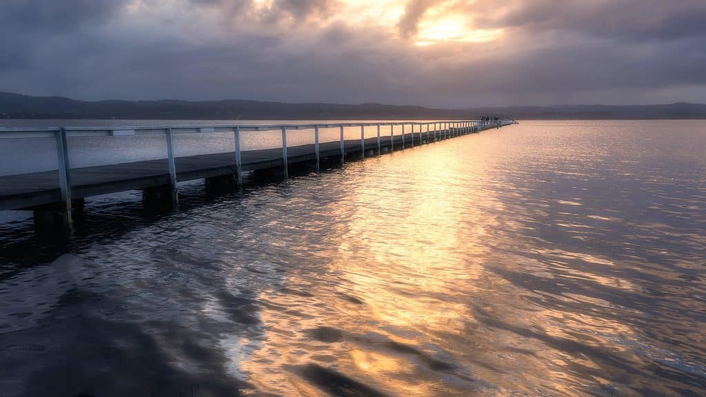
Long Jetty
Appropriately named, this is the home of numerous long jetties heading out over Tuggerah Lake, It is a very popular sunset and picnic spot for photographers and visitors to the Central Coast.
Grab some local fish and chips, head to the foreshore for dinner and sunset, you won’t be disappointed.
Long Jetty Location Information
Parking and access – Tuggerah Parade, Long Jetty. There are numerous jetties along this foreshore, so pick your favourite. Plenty of parking and amenities.
Google Maps Link – Watkin’s Jetty
Features – foreshore, jetties, huts.
Best conditions – best at sunset
Nearest coffee and breakfast – Not really relevant for sunset, but there are numerous cafes in the main street of Long Jetty, with my favourite being Modern Organic. For sunset, grab yourself a local burger or fish and chips from one of the local cafes.
Macmasters Beach
This is a lovely quiet location tucked away from the hustle and bustle of some of the busier suburbs on the Central Coast. and another very short walk from the car and best/safest at lower tides. There is however, no coffee close by so it’s BYO.
The pool is quite popular with local swimmers but it can be nice to have a strategically placed person in your shot sometimes.
MacMasters Beach Location Information
Parking and access – MacMasters Beach Surf Lifesaving Club. Limited parking at any time.
Google Maps Link – MacMasters Beach Surf Life Saving Club
Features – Rock pool, beach, headland
Best Conditions – low to medium tide.
Nearest coffee and breakfast – At the surf club but need to check opening times as these are seasonal. Less than a 5 minute drive away is Looloo’s Coffee Shack, MacMasters Beach.
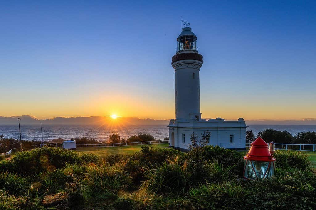
Norah Head
This is an active lighthouse and you can also book it to stay in the keepers quarters.
A very popular tourist location for good reason but at dawn it’s usually once again only fishers and photographers. You can shoot from up the top as in this photo or head down the steps to the beach and rocks for a plethora of compositions.
I noticed a coffee van there when I last visited but I couldn’t see the opening times (not when I was there unfortunately). Luckily there are a few cafes less than a 10min drive away in Noraville and Toukley.
Norah Head Location Information
Parking and access – Norah Head Lighthouse car park. Plenty of parking early mornings.
Google Maps Link – Norah Head Lighthouse
Features – Lighthouse from the top. Head down the stairs and left for rock shelf, formations and beach. You can also do a tour so head here if you’re interested.
Best Conditions – Most tides but check for swell if heading to the rock shelf.
Nearest coffee and breakfast – Surfside Snax, Soldiers Beach or The Local Brew, Noraville.
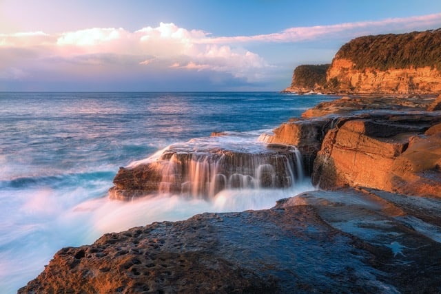
North Avoca
Much less famous than its neighbour, North Avoca is a lovely secluded suburb with fantastic rock shelves to shoot from.
North Avoca Location Information
Parking and access – North Avoca Surf Lifesaving Club. Easy to find a space for sunrise but gets very busy during the day. Short walk in front of the surf club to the left.
Google Maps Link – North Avoca Surf Life Saving Club
Features – beach rock pool, rock ledges, headland and waves
Best conditions – accessible most times but show caution at high tide and rough seas
Nearest coffee and breakfast – around 100m from the surf club, The Boy and The Rose
Patonga
Patonga is the as far south as you can go on the Central Coast for beaches. It’s a lovely tranquil and secluded little suburb.
For photos, think calm waters with fishing boats and a jetty.
If you’re a bit more adventurous consider the bushwalk that joins Patonga to Pearl Beach. This walk takes you through red gums and you’ll be treated with stunning views over Brisbane Water. You’ll need to allow a couple of hours to do this as you have to walk back!
Patonga Location Information
Parking and access – Patonga Wharf, Bay Street Patonga.
Google Maps Link – Patonga Wharf
Features – calm waters, boats. There is a bush walk that takes you over to Pearl Beach that provides numerous photographic opportunities and views – Full Details Here (https://www.wildwalks.com/bushwalking-and-hiking-in-nsw/brisbane-water-national-park/patonga-to-pearl-beach.html )
Best conditions – accessible anytime
Nearest coffee and breakfast – just across the road at The Boathouse Hotel – yes for coffee and breakfast. Also lunch and dinner, although it can get busy.
Pearl Beach
Located just north of Patonga is a lovely secluded beach suburb known to locals as ‘Pearly’.
This has a great rock shelf that seems to go forever with views over to Lion Island, as well as a rock pool.
Pearl Beach Location Information
Parking and access – Corner Pearl Parade & Tourmaline Avenue, Pearl Beach
Plenty of parking early in the day.
Google Maps Link – Pearly’s – Pearl Beach
Features – beach rock pool, rock ledges, headland and waves
Best conditions – accessible most times but show caution at high tide and rough seas
Nearest coffee and breakfast – Pearly’s which is right next to where you park. Opening hours do vary, so head to Ruby’s Cafe at Umina if Pearly’s isn’t open.
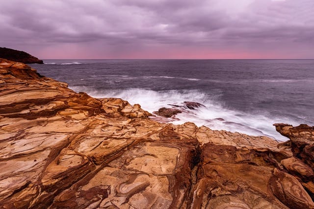
Putty Beach/ Bouddi National Park
Tucked away over near Killcare is this incredible place to shoot on the Central Coast. Erosion has caused some incredible rock formations and well worth the walk up the stairs.
Putty Beach Location Information
Parking and access – The end of Putty Beach Road – drive right to the end and park. Take the path and head left. You will walk along the beach for about 100m then follow the path up for about ten minutes. I suggest you do a scout beforehand if you’re heading there for sunrise, but this is also a good sunset spot.
Google Maps Link – Putty Beach Parking Lot
Features – incredible rock formations, rock ledges, headland and waves
Best conditions – accessible anytime, and works for both sunrise and a reverse sunset.
Nearest coffee and breakfast – Hardy’s Bistro, Killcare. This is just a few minutes drive away – and fabulous coffee!
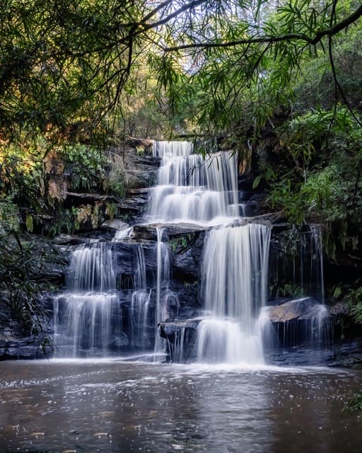
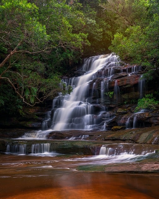
Somersby Falls
There’s no doubt that this three tiered waterfall is among the most beautiful spots to photograph on the Central Coast.
It is quite easy to access which makes it a very popular tourist attraction. As such, definitely go early if you can – you won’t be disappointed.
Somersby Falls Location Information
Parking and access – Plenty of parking (especially early). This is paid parking as it is a National Park.
Google Maps Link – Somersby Falls Parking
Features – three (more if you’re keen) levels of waterfalls and Aussie bush. Try to go during the week if you can as it can get extremely busy on the weekends. Full guide here.
Best conditions – best earlier in the day, but bear in mind that the carpark doesn’t open until 7am.
Nearest coffee and breakfast – Waterfall Cafe, Mount Penang Parklands which is about a ten minute drive.
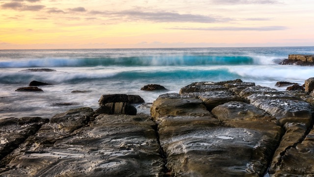
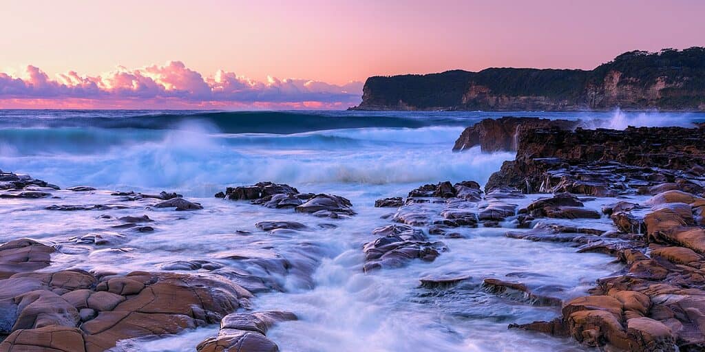
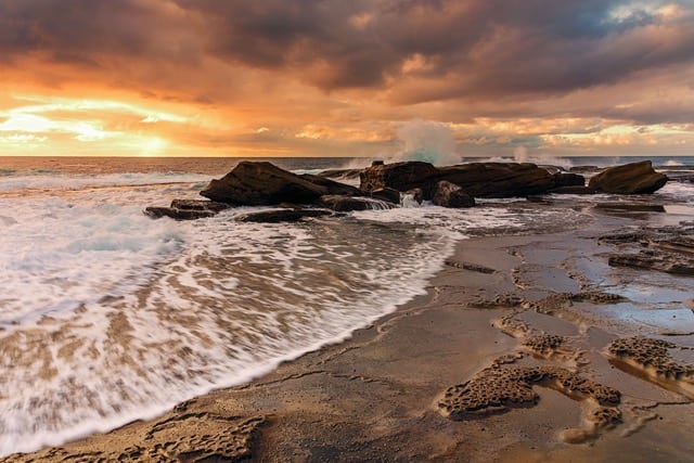
Spoon Bay
Spoon Bay is located within the Wamberal Lagoon Nature Reserve and is not very well known outside the locals. It’s really popular for beach walks and swimming, but be careful as it’s quite notorious for rips.
The changing tides expose a variety of different rock formations and can showcase spectacular patterns in the sand, so well worth the walk for photographing at sunrise.
It’s unlikely you will ever see many people there other than locals, usually walking their dogs.
Spoon Bay Location Information
Parking and access – The end of Spoon Bay Road, Forresters Beach. Stairs to beach then head left to the headland.
Google Maps Link – End of Spoon Bay Road
Features – Beach, rocks, rockshelf
Best Conditions – Low to medium tide
Nearest coffee and breakfast – di Matteos, Forresters Beach
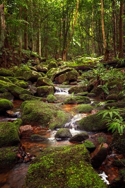
Strickland State Forest
This truly is an unsung hero as far as photo spots on the Central Coast go. It is well known for hikers, particularly those with dogs as it’s dog friendly.
The forest itself is only fairly small but it has a very impressive range of flora and fauna along the tracks.
As for photography, there are a number of picturesque streams throughout the area, plenty of nice forest scenes, birds and quite frequently fungi.
Don’t be fooled by the signs you will see mentioning ‘falls’ – they truly only trickle even after heavy rain. I suggest you stick to the loop trail mentioned below, particularly if you are short on time.
Strickland State Forest Location Information
Parking and access – Start at the Stoney Creek Car Park – this is the lower car park and follow the walk suggested below. There is quite a bit of parking, but it can get busy on the weekends. There are picnic tables and toilets at the upper carpark area, Banksia picnic area.
Google Maps Link – Stoney Creek Car Park
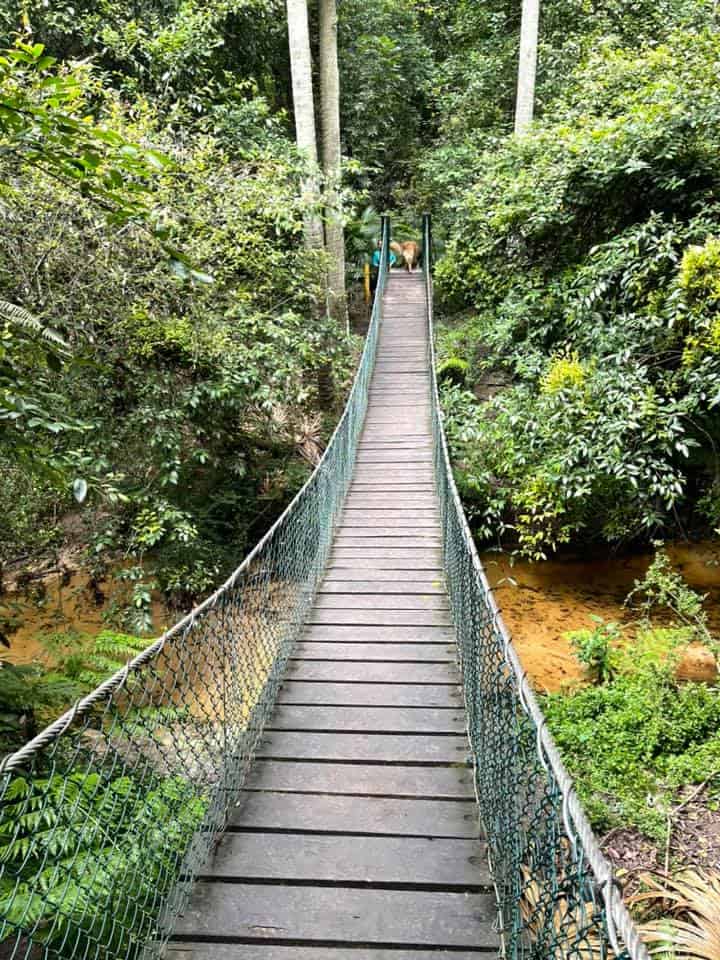
Features – Arboretum Loop Trail is a fabulous easy/moderate walk taking in numerous streams, and swinging bridge. Here’s a complete guide.
Best conditions – accessible most times but best after a bit of rain for some atmosphere. Well known for leeches, so go prepared.
Nearest coffee and breakfast – Lee Rowan’s Nursery is the closest cafe that I can recommend for here.
Terrigal
Terrigal is probably the most well known suburb to visitors from Sydney (and yes another one of the famous Central Coast photo spots that you’ll see on Instagram).
It is full of accommodation options, cafes, restaurants and retail therapy, so could be a good place to base yourself if visiting overnight or longer.
It really depends where in Terrigal you want to shoot to know which tide is better and whether rock shoes are needed – this is where planning in advance comes in. The one constant is there’s always coffee at hand anywhere here!
Terrigal Location Information
Parking and access – Varies – either the skillion, the Haven or the Surf Club. All can be busy at most times.
Google Maps Link – The Skillion
Features – Beach, the Skillion, rock shelf and formations at both the Skillion and the Haven
Best Conditions – All depending on tides.
Nearest coffee and breakfast – Bellyfish (near the surf club) or The Cove (near the Haven and the Skillion)
The Entrance
THE place for spotting pelicans, The Entrance also has some lovely spots to photograph. Head over towards the surf club for sunrise. You have the surf tower and baths to choose from.
Or visit at sunset to photograph over Tuggerah Lake, or shoot back from North Entrance and capture the bridge and fishing boats.
The Entrance Location Information
Parking and access – The Entrance Surf Club on Marine Parade. Try and park closer to the surf club if you want to photograph the rock pool.
Google Maps Link – The Entrance Surf Club
Features – Rock pool, beach, headland
Best conditions – sunrise at low to medium tide. If visiting in the afternoon, head over to Picnic Point Reserve for sunset over Tuggerah Lake.
Nearest coffee and breakfast – Euro Bean Cafe & Bar, the Esplanade, The Entrance. A couple of minutes drive, park in the free public parking next to the Memorial Park.
Great spot to grab fish and chips nearby and enjoy sunset at Picnic Point Reserve, or the Memorial Park.
Umina Point
Umina is a busy coastal village at the southern end of the Central Coast. It is a popular destination for visitors and is less than an hour and a half from Sydney.
This is the suburb I grew up in yet I have only ever photographed twice. The first time was my very first sunrise when I started photography and the second was only a few weeks ago. It is a very easy walk from the car and depending on the tide whether you shoot from the sand or put your rock shoes on and head around the rockshelf.
This is also an off-leash area for dogs so to be noted if you’re not comfortable with this.
Umina Point Location Information
Parking and access – Corner of Berrima Cres & Mount Ettalong Rd, Umina. Small carpark with around a dozen parking spaces.
Google Maps Link – Umina Point
Features – beach, rock formations, headland.
Best Conditions – accessible at all tides but only low tide to access rocks around the point.
Nearest coffee and breakfast – Ruby’s Cafe & Books, Umina
Woy Woy Waterfront
‘Woy Woy’ is believed to originate from the Aboriginal word ‘Wy Wy’, which means ‘much water’ or ‘big lagoon’. This is quite appropriate as it is pretty much completely surrounded by water.
For photography you can choose from anywhere along The Boulevarde to the more secluded walking path highlighted below.
Head there on a still morning and you will be treated to some beautiful sights with trees and boats reflecting perfectly on Brisbane Water.
Such a lovely calm start to the day, and don’t forget to look for pelicans and other birds.
Woy Woy Waterfront Location Information
Parking and access – Farnell Road, just off Burge Road. Very limited parking so you may need to park on Burge Road. Still just a very short walk to the reserve. Once on the reserve, head left for a couple of jetties and boats. Head right for the same, as well as Pelican Island and views over to St Huberts Island
Google Maps Link – 1A Farnell Rd
Features – reserve with boats, small jetties, pelicans and views over to St Huberts Island and Rip Bridge.
Best conditions – accessible most times and best at sunrise.
Nearest coffee and breakfast – Hardwick Cafe at Woy Woy. This doesn’t open until 7.30am, so if you’re earlier, head to Ruby’s Cafe at Umina that opens at 6am for coffee, and the kitchen opens at 7am.
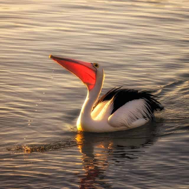
Pelicans!
Ok, so this is not a location, but pelican spotting is a really easy photography sport on the Central Coast.
The Entrance in particular is a location where you are pretty much guaranteed to see them up close for photos.
For many years, you could attend the regular feeding session at The Entrance daily. This was put on hold during the pandemic but they are looking at bringing it back. This is the place to follow to see if it’s up and running again – Central Coast NSW Australia
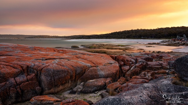
Catherine Hill Bay
Now technically this is not actually on the Central Coast (by about 3km) but is definitely worth an honourable mention (and us Coasties would love to claim it as our own.
Catherine Hill Bay is an old mining village that is heritage listed and home to a disused coal loading jetty that is more than photo worthy. There aren’t any shops or restaurants here, just the local Catho pub that is open for lunch and dinner. Very much worth a visit.
Catherine Hill Bay Location Information
Parking and access – Catherine Hill Bay Surf Lifesaving Club – plenty of parking.
Google Maps Link – Catherine Hill Bay Surf Life Saving Club
Features – beach, rocks, jetty.
Best Conditions – definitely low tide only
Nearest coffee and breakfast – Swansea (10 minutes towards Newcastle) or Budgewoi (15 minutes towards Sydney).
Conclusion
That’s it, my favourite Central Coast photo spots – have I missed any? It may take you a few visits to tick them all off, but totally worth it.
Where will you head to first? Please let me know in the comments below.
I truly hope you’ve enjoyed this post.
That’s it for now – Keep clicking and stay caffeinated
Like this post? PIN it so you can save it for later
Here’s some more articles and resources I think you’ll like:
- How Revisiting Same Locations Can Improve Your Photography
- Planning A Photography Shoot
- Essential Landscape Photography Gear
- How To Photograph Waterfalls
Don’t miss a post – sign up Here if you haven’t already
Note – This post does not contain any sponsored or affiliated links. All suggestions and opinions are mine. Unless otherwise stated, all photos are mine and remain my copyright images – Sam Wilson Photography.
I am not a photographer myself Sam, but I enjoy good photography. Yours is breathtaking, thank you for sharing.
Hi Gabrielle
thank you so much for your lovely comment – glad you enjoyed 🙂